
|
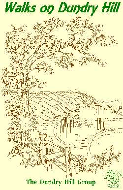
WALKS BOOK |
The Dundry Hill Group were busy during
early 2001 walking the area to find routes to be included in the Walks
on Dundry Hill book.
Ten interesting walks have been chosen; for each one there is a
route description, map, and information on history, geology,
archaeology and interesting sights along the way.
The walks take you along ancient lanes, past the Iron Age hill
settlement of Maes Knoll, through ancient woodland at Bitham's
Wood, through farmland, past rivers and streams and to places
where you can admire the breathtaking views of area.
The Group recruited local residents, school groups, walking clubs
and anyone with an interest in walking or the area to help write
and check routes and information.
There is a range of walks from easy to hard, circular to linear,
and from short to long. The book is beautifully illustrated with
Anton Bantock's line drawings and additional information is
included on local wildlife, history and facilities such as pubs,
shops and bus stops.
There is also be a report form for people to fill in to help us
address any difficulties that they may find.
The book has been produced with the help of North Somerset County
Council, Bristol City Council and Bath, North East Somerset
Council and The Forest of Avon.
Walks on Dundry Hill is now out of print, but we know
that it has been available at some local libraries, so try
asking!
For further information, contact (0117) 964 3106 or e-mail andrec@mvcg.org.uk.